

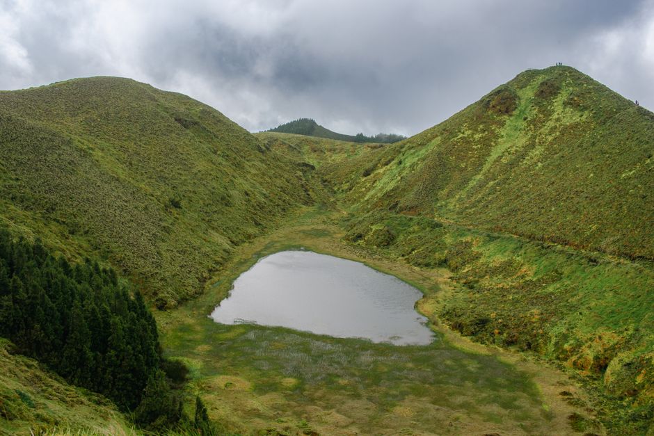
Sao Miguel’s best scenery comes from volcanic viewpoints, crater lakes and coastal cliffs—but the trails vary a lot in time, steepness and conditions. Use the guide below to choose hikes that match your pace, then follow the trailhead logistics so you don’t waste half your day driving back and forth.
Easy Walks and Viewpoints

Vista do Rei (Sete Cidades)
From the Sete Cidades rim, Vista do Rei gives you the classic panorama over the twin lakes: Lagoa Azul and Lagoa Verde. The “hike” here is really a lookout walk—great if you’re travelling with mixed fitness levels.
- Difficulty: Easy (short walk, uneven ground)
- Typical time: 30–60 minutes, depending on stops
- What you’ll see: Lake-and-caldera views, often with changing light and fast-moving clouds
How to use it: Pair this with a second Sete Cidades stop (like a lake shoreline walk) so you build in time rather than moving cars twice.
Caldeira Velha Boardwalks and Waterfall (Furnas)
Caldeira Velha is a thermal area with a path that leads through a humid valley to a waterfall and steaming ground. It’s ideal if you want nature without a long ascent.
- Difficulty: Easy to easy-moderate (mud and steps)
- Typical time: 1.5–2.5 hours
- What you’ll see: Hot springs, waterfall views, lush forest
What to watch for: Trails can be slick after rain. Bring footwear you don’t mind getting muddy.
Boca do Inferno (North Coast)
Boca do Inferno is a dramatic cliff viewpoint designed for quick access rather than a long circuit. On a clear day, you’ll get wide ocean views; on rougher weather, the waves look even more impressive.
- Difficulty: Easy to easy-moderate (short cliffside walk)
- Typical time: 45–75 minutes
- What you’ll see: Atlantic cliffs, surf and coastal rock formations
Tip for comfort: Plan this earlier in the day if you’re hoping for the best visibility—fog often rolls in as the afternoon goes on.
Moderate Day Hikes

Lagoa Verde and Lagoa Azul Shoreline Route (Sete Cidades)
For lake views that feel “close-up,” choose a shoreline-style circuit around Sete Cidades’ twin lakes. It’s one of the best options if you like a steady trail without a huge technical climb.
- Difficulty: Moderate (distance + some elevation changes)
- Typical time: 3.5–6 hours, depending on how far weaves in and out
- What you’ll see: Both lakes from varied angles, volcanic edges and forested stretches
Plan it like this: Start early, bring water, and be ready for changing weather. The caldera can switch from bright to misty quickly.
Lagoa do Fogo Rim Hike (Nordeste / near Lagoa do Fogo)
Lagoa do Fogo is a crater lake where the views improve as you gain elevation. The rim path is the main draw—think “walk to the edge, then stop often.”
- Difficulty: Moderate (steady ascent in places)
- Typical time: 3.5–5.5 hours
- What you’ll see: The lake below, cloud layers, and sweeping ridgeline views
When it feels hard: The trail is often less about technical difficulty and more about sustained uphill walking on humid days.
One Coastal Viewpoint Circuit on the North Shore (Ribeira Grande area)
If you want moderate effort with ocean reward, combine a couple of short segments on the north coast around Ribeira Grande rather than committing to a single long loop. This keeps options open if weather turns.
- Difficulty: Moderate (choose shorter segments if visibility drops)
- Typical time: 2.5–5 hours total
- What you’ll see: Cliff viewpoints, coastline texture, and sea conditions
Why it works: You can tighten or lengthen the plan based on wind, spray and cloud cover.
Strenuous and Long Walks
These are for days when you can hike for most of the daylight and you’re comfortable with steep terrain, wet surfaces and altitude changes. If you’re unsure, take a guided option or shorten the route to the strongest viewpoint section.
Caminho do Rei (Sete Cidades)
Caminho do Rei is one of Sao Miguel’s most memorable hikes because it links the Sete Cidades plateau to the lakes below. The route includes steep stair-like sections and switchbacks, so even “just one section” can feel demanding.
- Difficulty: Strenuous (long, steep climbs/descents)
- Typical time: 4.5–7 hours depending on distance and how many viewpoint stops
- What you’ll see: Switchback views over the caldera and lakes
How to hike it well: Start early, keep a steady pace, and don’t treat it as a “quick photos” outing. Wet stone can be unforgiving.
Pico da Vara (Highest Point on Sao Miguel)
Pico da Vara is the island’s highest peak and the payoff is huge—when visibility is good. The climb is typically sustained, with sections that feel exposed when wind picks up.
- Difficulty: Strenuous (altitude + long climb)
- Typical time: 5–9 hours total depending on route length and conditions
- What you’ll see: Panoramas across central Sao Miguel, often above cloud layers
Weather reality check: In fog or heavy rain, the hike can be more about endurance than views. If you’re heading up, have a conservative plan for turning around early.
Getting Around Between Trailheads
Sao Miguel is easiest with a rental car, especially if you want to string together Sete Cidades + Furnas + the east side in a single day. Public transport exists, but frequency can be limited, and trailheads are often not right next to main stops.
Driving and route grouping (to reduce backtracking)
Plan by regions so you don’t spend your day crossing the island.
- Sete Cidades cluster (west): Vista do Rei + lake routes + Caminho do Rei
- Furnas cluster (southeast/central): Caldeira Velha + the surrounding thermal valley
- Northeast viewpoints: Lagoa do Fogo and onward to higher ground like Pico da Vara
- North coast (coastline views): Boca do Inferno and short coastal viewpoint segments near Ribeira Grande
From Ponta Delgada, expect roughly an hour or more to reach the far ends depending on traffic and road conditions—then add extra time for parking and walking to trailheads.
Trailheads, parking and time buffers
Common-sense logistics make these hikes smoother.
- Start earlier than you think you need: Morning weather on the islands tends to be more stable.
- Bring cashless-friendly payment only if required in your area: Some parking and entry arrangements vary by site; verify locally once you arrive.
- Allow a buffer of 15–30 minutes for finding parking, walking from the lot, and dealing with misty conditions.
- Use footwear for wet ground: Even “easy” routes can be slippery.
Car planning for day-to-day hikes
If you’re doing more than one hike in a day, choose the order based on exposure to weather.
- Do crater-lake and summit options earlier (they’re most rewarding when visibility is good).
- Save short, flexible viewpoints for later if clouds roll in.
- If you’re hiking Pico da Vara: treat it as the anchor activity of the day. You’ll want buffer time for slow driving, changing weather and a possible early turn-around.
Final Thoughts
Choose one “anchor” hike per day—either a crater route (Lagoa do Fogo or Sete Cidades) or a summit-style day—and fill the remaining time with shorter viewpoints. Once you pick your dates, map which trailheads belong to the same side of the island so you keep driving time down and hiking time up.